8,000 SLO properties added to fire hazard zones. Why homeowners are concerned
Cal Fire added thousands of San Luis Obispo properties to a new map that identified fire-prone areas in California this year — and now those property owners will need to retrofit their homes and yards to be more fire-resistant.
The Fire Hazard Severity Zone map identifies the likelihood of a fire in a particular area based on the vegetation type, weather conditions, fire history, terrain and how far embers could travel.
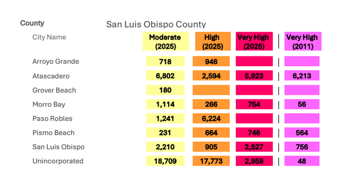
In the previous map, 38 parcels in San Luis Obispo were included in a Fire Hazard Severity Zone.
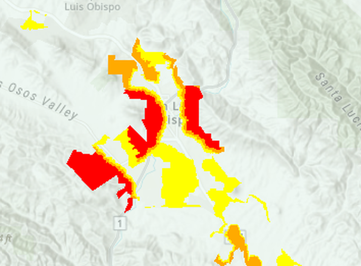
This year, San Luis Obispo saw a massive expansion of the zones. In the new map, 8,782 parcels were included in one of the three zones, with 2,845 parcels in a “very high” zone, San Luis Obispo City Fire Department Chief Todd Tuggle said.
Those properties must meet fire-resistant building standards and clear defensible space around their property.
“We are not powerless,” Tuggle said. “We have a certain ability to mitigate the risk of wildfire.”
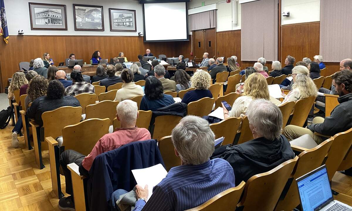
On Tuesday, staff introduced the state’s new Wildland Urban Interface code to the San Luis Obispo City Council, and explained how the updated map and regulations will impact property owners.
While following the regulations will be necessary for preventing wildfires from spreading into neighborhoods, council member Michelle Shoresman acknowledged that complying with those regulations will be expensive.
“We’re trying to do it the easiest way possible for both our staff and community members, but it’s going to be painful,” she said.
What do fire maps mean for property owners?
The map includes three zones for fire hazard severity: moderate, high and very high.
New homes built in a “high” fire hazard severity zone must meet fire-resistant building standards and notify potential buyers of the fire hazard.
Homes in a “very high” fire hazard severity zone must meet the same regulations, and residents must also clear defensible space around their property.
This requires the removal of all grass, plants, shrubs, fallen leaves, weeds and combustible mulches like bark and wood chips within 5 feet of their home, the staff report said.
Meanwhile, trees on the property must be trimmed, so that all live branches are at least 5 feet higher than the building’s roof, 5 feet away from the side of the building and 10 feet away from any chimneys. Dead plant debris must be removed from the roof, gutter, porch and stairways, while combustible fencing must be replaced within 5 feet of the building.
All dead plants, shrubs and trees must be removed within 5 and 30 feet of the structure, while annual grasses must be mowed to a maximum height of 4 inches from 30 to 100 feet of structures on the property, the staff report said.
The city will implement a complaint-based enforcement system, which means the Fire Department will inspect a property when it receives complaints from community members, Tuggle said.
However, the city’s intention is not to penalize property owners, it’s to educate them and support them in making their home more resilient to wildfire, Tuggle said.
“Our first focus is going to be on education,” he said. “We want to meet with those property owners and talk with them and take a look and share the knowledge that we’ve been able to accrue.”
The city will also offer a voluntary enforcement program, where property owners can request an inspection from the Fire Department for a fee. The city will search for grants to subsidize the voluntary inspection program, Tuggle said.
City staff will return to the City Council in November with the official regulations, and the City Council will vote to implement them in December. If all goes according to plan, the regulations will be in effect at the start of 2026.
What do SLO residents think of the regulations?
San Luis Obispo resident Jay Walter is a “newly minted member” of the “very high” hazard zone, he said during public comment at the meeting.
He reminded the City Council that meeting the new requirements — from cutting down trees to replacing fences — will be expensive.
“The burden on the homeowners will be tremendous,” Walter said.
He urged the city to hold up their end of the regulations, and make vegetation management a priority in open spaces so wildfires are less likely to spark and spread into residential areas.
“That’s a key element to helping those fires not get out of control,” he said.
San Luis Obispo resident Carolyn Herzog was also added to a “very high” hazard zone this year.
“I 100% agree with it,” she said, adding that she had been evacuated from her home twice during the last 18 months because of fires.
To reduce the fire risk on her property, she applied to the city to remove two oaks trees growing 3 feet away from her house.
“They overhang my roof, they drop a ton of weeds, it’s a whole mess,” she said.
But in August, the city denied her a permit because the trees were deemed not to be a safety issue.
She advised the city to exempt property owners living in a “very high” hazard zone from needing a permit to remove trees from within 5 feet of their home to align with the state’s new requirements.
“My advice would be to consider just getting out of the way,” she said to the city.
Later, San Luis Obispo Tree Committee chair Ben Parker cautioned the City Council from being too lax with tree removal.
“There is a potential to be a real problem with people using the fire hazard risk to remove trees unnecessarily,” he said.
While some community members saw the new regulations as an unnecessary burden, others viewed them as an inevitable response to climate change.
Cal Fire said the expansion of fire hazard severity zones was driven by three factors: The state Legislature’s order to add “moderate” and “high” severity zones to the map, climate change-induced weather patterns that dried out vegetation and worsened fire weather, and improvements to Cal Fire’s modeling — allowing the agency to make more precise predictions about when and where extreme weather events will occur, as well as measuring ember cast, or how far an ember can travel.
Climate change-induced weather patterns dried out vegetation in the Western United States and “doubled the number of large fires between 1984 and 2015,” according to the National Oceanic and Atmospheric Administration.
Meanwhile, a 2021 study showed that climate change “is the main cause for increasing fire weather,” according to a peer-reviewed report published in the Proceedings of the National Academy of Sciences Journal.
“Wildfire risk really feels like climate change coming home to San Luis Obispo,” SLO Climate Coalition board executive chair Eric Veium said during public comment. “It’s beginning what seems like a really long nightmare that we’re going to start to enter into.”
He said it’s critical for communities to invest in infrastructure that is resilient to climate change-induced weather patterns, like worsening wildfires. But the city also should continue to reduce greenhouse gas emissions to fight climate change, too, Veium said.
New map jepordizes Froom Ranch subdivision
The city’s General Plan prohibits the construction of subdivisions in “very high” Fire Hazard Severity Zones.
One purpose of this rule is to “mitigate wildfire hazards and reduce risks to new development,” according to the city’s Climate Adaptation and Safety Element.
The expansion of the “very high” hazard zone will significantly impact the Froom Ranch subdivision planned along Los Osos Valley Road between Highway 101 and the Irish Hills Plaza.
The 110-acre property could include multi-family housing, senior housing, assisted living care and hiking trails.
When the city adopted the Froom Ranch specific plan in 2020, only 13 acres of the site were in a “very high” hazard zone, according to San Luis Obispo community development director Timothea Tway.
With the new map, however, the entire property is located in a “very high” hazard zone, she said.
As a result, the developer must apply for a Specific Plan amendment and a General Plan amendment to proceed with building the subdivision, Tway said.
Because this is a city policy, the City Council can vote to change the rule and allow future development in “very high” hazard areas, she said.
Staff recommended that the City Council schedule a study session to discuss the future of this policy.
Shoresman said this points to a conflict between the state’s goals to build more housing while keeping housing out of “very high” hazard areas.
“It’s going to be huge to our ability to build more housing and create more housing for our residents,” Shoresman said.