New San Andreas study to look at how a creeping fault affects the places where we live
READ MORE
Life on the San Andreas: A 4-part series
This is a 4-part series on life in Parkfield, California, the science of its seismology, and its distinction as “Earthquake Capital of the World.”
Expand All
Life on the San Andreas: Tiny Parkfield is unshaken as ‘Earthquake Capital of the World’
This California town is one of the most studied earthquake locations on Earth. Here’s why
New San Andreas study to look at how a creeping fault affects the places where we live
California has an earthquake early warning system. Here’s how to get alerts
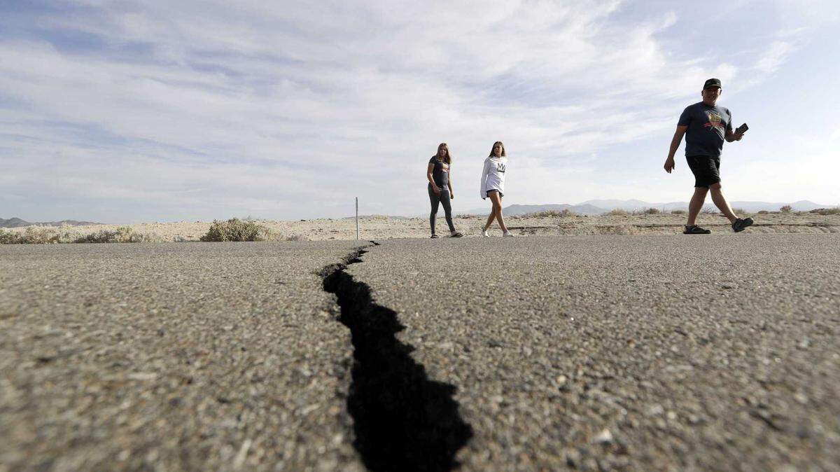
Earthquakes shake the ground on which our cities are built, but it’s not only the dramatic seismic movements that pose a threat.
All around the state, engineers and community planners must consider how faults and their movement could affect a planned building’s foundation, a bridge’s supports or a town’s water supply.
In doing so, they don’t only worry about quakes. They’re also concerned with the regular, more subtle forces at work from plate movements, in particular how they affect the places where we live.
Every day in the east Bay Area, which sits directly over a major fault, those forces are shifting curbs, cracking roads and ever-so-slowly tearing UC Berkeley’s football stadium in half.
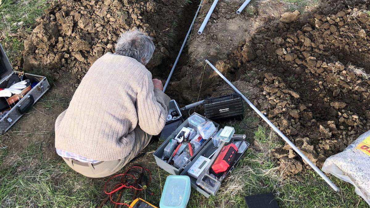
Now, scientists at the U.S. Geological Survey (USGS) and other universities are conducting a new study to learn more about what happens as faults slip near the Earth’s surface.

Scientists study creeping San Andreas Fault
The study, led by USGS earthquake scientist Josie Nevitt, is taking place on the section of the San Andreas Fault that passes through Peach Tree Ranch in eastern Monterey County.
The study site is located about 30 miles northwest of Parkfield, commonly known as the “Earthquake Capital of the World” and the location of countless fault studies.
Peach Tree Ranch, formerly known as Mee Ranch, lies along part of the San Andreas Fault that is continuously slipping at around one inch per year, Nevitt said.
Big quakes don’t generally occur because weak minerals make the fault surface slippery, allowing the North American and Pacific tectonic plates to glide smoothly and continuously past one another.
That makes the location well-suited for this study as researchers examine what happens when a fault slips gradually over time, as opposed to waiting for a big quake to come along.
Fault slip just below the surface
Deep underground, slips happen in a discrete band right along the fault. But near and at the surface of the Earth, the movement is less distinct. Rocks are broken due to exposure to the elements or are covered with dirt, so faults behave differently, Nevitt said.
This area is of particular concern because roads, buildings, telecommunications and pipelines are all either at the surface or buried just below it.
“That’s where our infrastructure is,” Nevitt said.
Nevitt said she and her fellow researchers want to know over how wide an area a fault can cause deformation. Any movement where structures are located can cause problems.
“We’re trying to characterize the fault zone,” the USGS scientist said.
Five decades of data
The researchers are using at least six different instruments to study the fault.
Scientists have been monitoring the slip rate at this property since the early 1970s, Nevitt said. Every so often, researchers survey the precise location of permanent markers on either side of the fault.
Earlier this year, the team imaged the Earth’s crust down to roughly 160 to 330 feet below the surface, Nevitt said.

The researchers are using another instrument to take a high-resolution image of the top 30 feet. From these data, they will learn about the precise geometry of the fault just below their feet.
Once the scientists pair that knowledge with information they will obtain from satellites about just how exactly rocks are moving around at the surface, they will begin to understand how broad the zone of slip can be in this type of setting.
The researchers are even planning to drill into the fault and collect rock samples to see how the fault deforms the rocks around it far below the surface. They’ll also use that hole to measure slip along the fault at depth.
The team will then be able to compare measurements of slip taken within the drill hole to those taken at the surface.

The results of the study could help improve earthquake hazard maps, Nevitt said, noting that current USGS estimates of seismic hazard generally consider data collected only at the surface.
“We really don’t understand how those measurements relate to slip at depth,” Nevitt said.
Through the study, researchers also hope to learn how steady fault movement affects the surface, she said.
“If you think of the Hayward fault, people are living right on top of it,” she said. “You really want to know what that (deformation) zone looks like.“