This California town is one of the most studied earthquake locations on Earth. Here’s why
READ MORE
Life on the San Andreas: A 4-part series
This is a 4-part series on life in Parkfield, California, the science of its seismology, and its distinction as “Earthquake Capital of the World.”
Expand All
Life on the San Andreas: Tiny Parkfield is unshaken as ‘Earthquake Capital of the World’
This California town is one of the most studied earthquake locations on Earth. Here’s why
New San Andreas study to look at how a creeping fault affects the places where we live
California has an earthquake early warning system. Here’s how to get alerts
The “Earthquake Capital of the World,” tiny Parkfield, California, didn’t earn the title by having the biggest or even the most earthquakes.
It gained the distinction because it lies on top of a unique part of the San Andreas Fault that consistently produces a strong temblor every couple decades. Over the past 164 years, the Central Coast town in southern Monterey County has experienced a record of seven roughly magnitude-6.0 earthquakes.
The seemingly predictable pattern fascinated geologists, who flocked to the area in the 1980s and ’90s in hopes of capturing one of the quakes as it happened. But the fault went quiet, and the next large temblor didn’t arrive until 2004.
“This is a place that has been studied more intensely than probably anywhere else in the world,” said Justin Rubinstein, a seismologist with the U.S. Geological Survey (USGS).
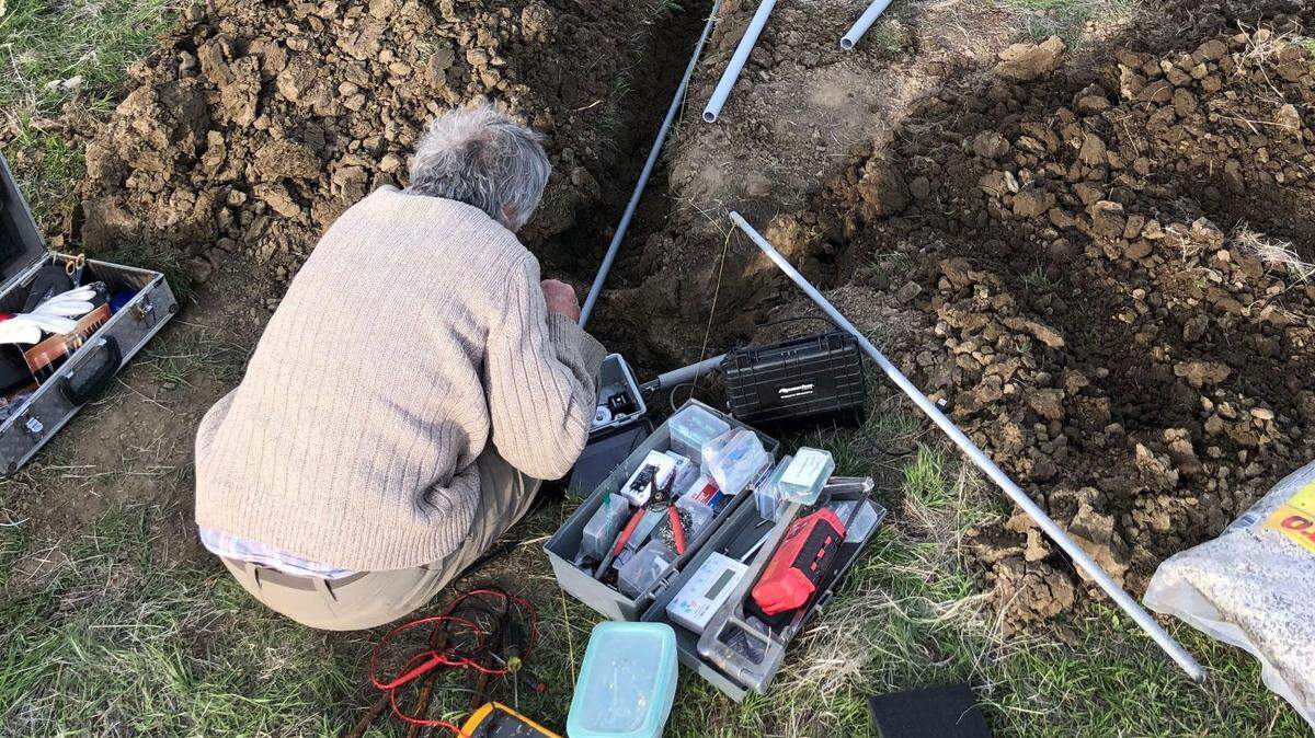
Over the years, scientists have sampled, drilled, measured and instrumented the San Andreas in this area, keeping a watchful eye out for any indication that it may rattle again.
While they wait, they are learning about how earthquakes work.
How faults cause earthquakes
The Earth’s outer layer is a jumbled up mess — a fractured and deformed crust of rock stretched and compressed over millions of years. Its jigsaw pieces slowly groan past one another along faults that extend miles below the surface.
Although fairly straight, faults are by no means smooth surfaces. Blocks of land don’t generally slide gracefully past one another.
Bumps on fault surfaces generate friction, making them sticky.
A fault essentially acts like two pieces of coarse grit sand paper. Slowly rubbing those high friction surfaces together results in jerky slip between the pieces.
The constant force of Earth’s shifting crust causes rocks on either side of a fault to intermittently lurch along when that force overcomes friction, each time producing an earthquake. The bigger an area of the fault surface that slips, the bigger the earthquake.
Where friction is high, faults are “locked” in place between earthquakes.
But fault surfaces sometimes contain very weak minerals — often a byproduct of a chemical reaction between water and certain rocks.
Like a sprinkling of talcum powder, these minerals lubricate the fault and allow rocks to slowly “creep” past one another without producing earthquakes.
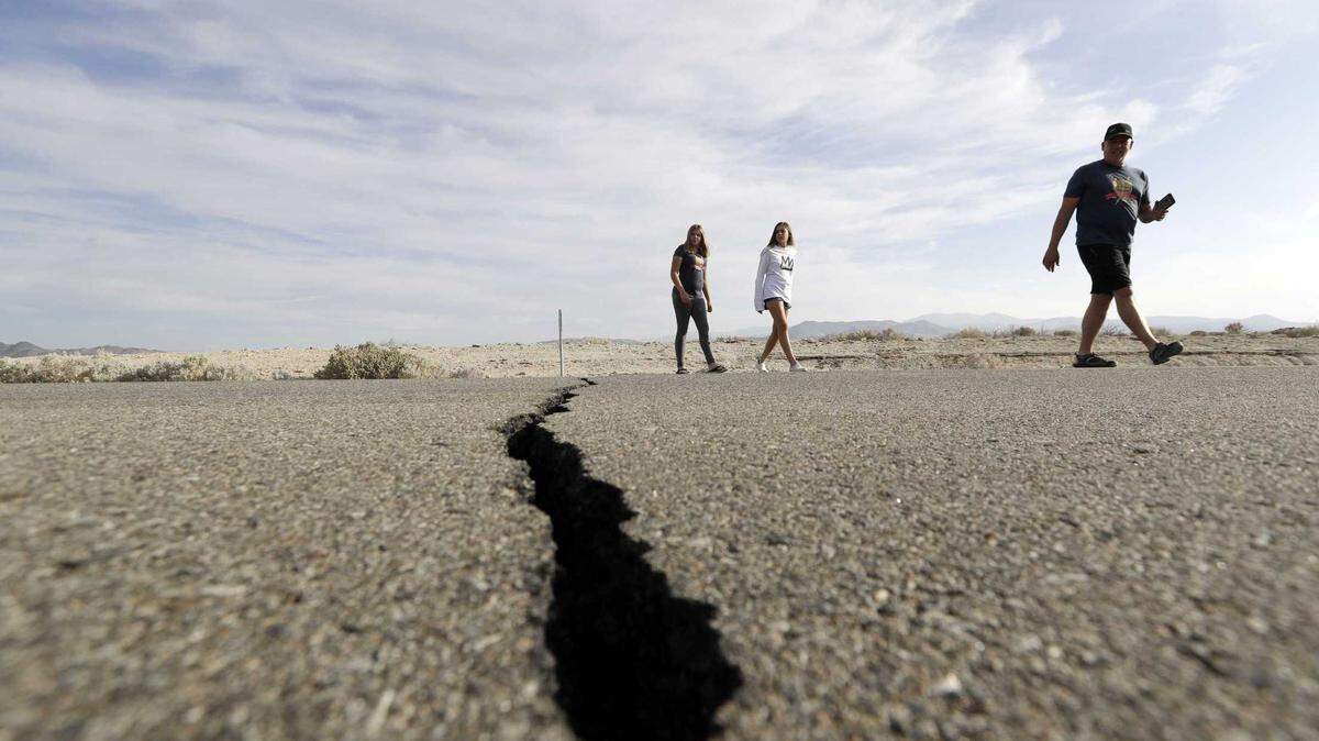
The San Andreas has both locked and creeping sections along its 800-mile stretch through California.
The San Andreas is actually many faults
North of San Juan Bautista, the San Andreas is mostly locked.
The last time it slipped in a major way was in the 1906 San Francisco Earthquake. The magnitude-7.9 temblor and subsequent fires destroyed a large portion of the city.
In that quake, the fault slipped up to 32 feet along a 296-mile stretch from San Juan Bautista to Cape Mendocino, according to the USGS.
The San Andreas is also locked south of Parkfield into Southern California.
In 1857, a total of 225 miles of the fault — from just south of Parkfield to Cajon Pass on Interstate 15 — slipped during the Fort Tejon Earthquake. That magnitude-7.9 quake, researchers believe, may have started near Parkfield and zipped south as the area that slipped grew.
Between these two sections, the San Andreas is creeping at up to nearly one inch per year. It does not produce the really big earthquakes that strike the locked sections.
That’s not to say that the entire section couldn’t slip in a big quake. “We don’t know for sure. But it’s not the most likely thing to happen,” said Bill Ellsworth, a seismologist at Stanford University.
So, what’s the deal with Parkfield?
Parkfield lies at the southern end of the creeping section, which is a transition zone between the locked and creeping fault, Ellsworth said.
Here, the fault is like a vertical checkerboard of small creeping and stuck patches, he said. South of Parkfield, the fault is one giant stuck patch.
Scientists are still trying to figure out why the San Andreas behaves this way.
“We think geology is the main control,” Ellsworth said.
Where the fault is strong, it’s locked. Where weak minerals lower the friction on its surface, the fault creeps.
The presence of serpentinite — California’s state rock — seems to dictate where the fault is weak, according to the USGS and several scientific publications.

Repeating earthquakes in the checkerboard
In the small stuck patches, scientists have observed thousands of roughly magnitude-2 earthquakes that repeatedly strike the same locked patch about every two to three years, Ellsworth said.
The size of the patch controls the exact size of the quake, he added.
“We think of the Parkfield main (magnitude-6.0) shock as being one of these repeating earthquakes that happens every 25 years or so,” Ellsworth said.
This patchy area is fractal in a way, the Stanford researcher said. Smaller checkerboard squares make up larger checkerboard squares, which make up even larger squares.
These larger quakes are not exact copies of one another however, as the smaller repeaters appear to be, but they share many of the same characteristics.
Repeating earthquakes large and small are not unique to the Parkfield area, but they don’t occur everywhere, Ellsworth said.
“In general, we see repeaters in areas where we see active creep,” Rubinstein said.
Parkfield quakes are regular, but unpredictable
Up until recently, the magnitude-6.0 quakes near Parkfield struck fairly regularly — about every 22 years. The most recent one, in 2004, however, came a full 38 years after the previous one. Attempts by the USGS to predict that quake, due around 1988, ultimately failed.
“I think the last one showed us that it’s not as regular as we really thought,” Rubinstein said.
Despite the intense monitoring of the area, not a single instrument recorded a signal of an impending earthquake prior to the 2004 temblor. In this, the most well-studied fault in the world, earthquake prediction remains beyond reach at this point.
But scientists are still learning from the hundreds of small quakes that rattle the area each year as they continue to monitor the fault.
Data and rock samples collected from a major drilling experiment in the early 2000s lead scientists to attribute fault creep to weak minerals found along the fault surface.
They are learning about how earthquakes start, how they are triggered and how forces causing quakes are distributed.
“Now that we have this mass of observations. It’d be a huge loss to not keep digging there,” Rubinstein said.
This story was originally published September 1, 2021 at 5:00 AM.