
What’s the forecast for SLO County? Cold, rainy weather expected to stick around this week
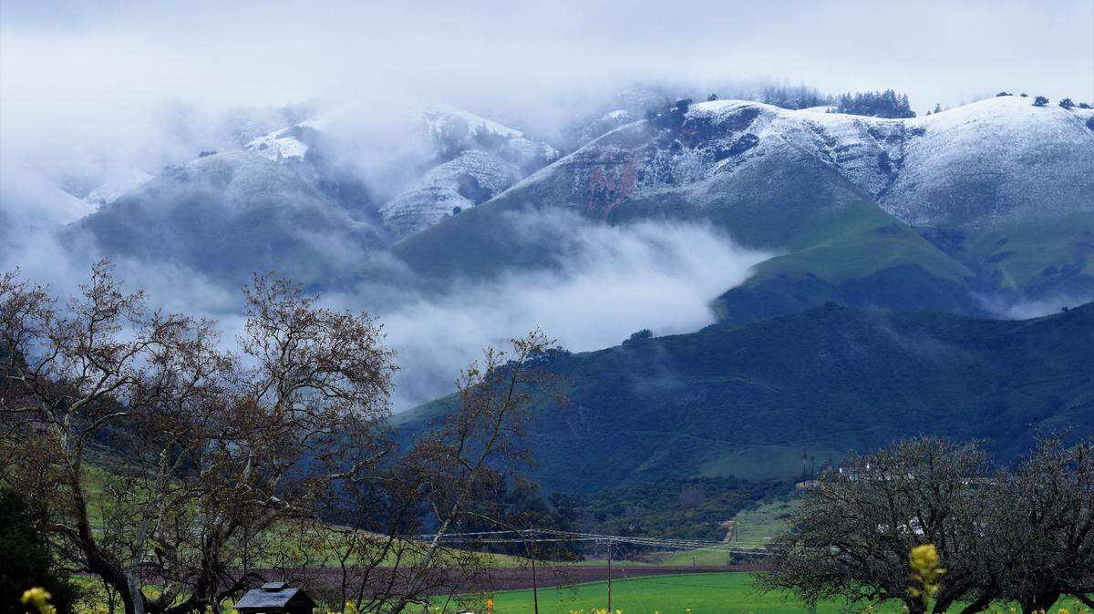
The San Luis Obispo County rain gauge in Cambria and Rocky Butte typically report the most rainfall on the Central Coast; however, Cambria recorded one of the lowest 24-hour rainfall totals at 1.36 inches due to the trajectory of Friday and Saturday’s storm. Locations to the east and south reported much more significant amounts.
Rain gauges in the Lopez Lake watershed reported over 4 inches of rainfall; consequently, Lopez Lake went from 55.3 percent to 58.0 percent of capacity in just 36 hours as of Saturday at noon. The Salinas Dam gauge recorded 5.4 inches of rain.
Not only did we see plenty of rain, but locations away from the ocean saw snow. In fact, snow levels dropped to 500 feet in Paso Robles on Friday night.
Sunday will be between two cold fronts, one to the north and the other to the south. It will be dry and cold on Sunday under partly cloudy skies.
Highs on Sunday will only reach the low-50s, with lows falling to the low-30s in the inland valleys (Paso Robles) and high-30s in the coastal valleys (San Luis Obispo).
A cold front will move to the Central Coast on Monday into Tuesday with fresh to strong (19 to 31 mph) southerly winds and periods of rain. Total rainfall amounts with this system should be about 1 inch. Snow levels will be near 2,500 feet.
March will start windy and cold as a steep pressure gradient develops as a 1,041 millibar Eastern Pacific High to the west-northwest and a trough of low pressure moves to the southeast. This condition will create moderate gale-force to fresh gale-force (32 to 46 mph with gusts up to 55 mph) northwesterly winds and rain on Wednesday.
High pressure over the Great Basin will produce gusty Santa Lucia (northeasterly and offshore) winds from Thursday into Saturday. This offshore flow will create primarily clear skies with cold mornings but warmer afternoons.
The next chance for rain will be on March 5.
Surf report
A 5- to 7-foot westerly (275-degree, deep-water) swell (with an 8- to 12-second period) is expected along our coastline on Sunday, decreasing to 4- to 6-feet (with an 8- to 14-second period) on Monday morning.
A 6- to 8-foot northwesterly swell (with an 8- to 13-second period) will arrive along our coastline on Monday afternoon and remain at this height through Tuesday.
Increasing northwesterly winds off the California coastline will generate a 12- to 14-foot northwesterly (310-degree, deep-water) sea and swell (with a 5- to 11-second period) on Wednesday, decreasing to 5- to 7-feet on Thursday, and 3- to 5-feet by Friday.
Seawater temperatures will range between 50 and 52 degrees through Friday.
This week’s temperatures
LOWS AND HIGHS, PASO ROBLES
SUN | MON | TUE | WED | THU | FRI | SAT | SUN |
33, 52 | 39, 52 | 35, 51 | 34, 52 | 31, 57 | 33, 58 | 33, 59 | 34, 60 |
LOWS AND HIGHS, SAN LUIS OBISPO AND COASTAL VALLEYS
SUN | MON | TUE | WED | THU | FRI | SAT | SUN |
39, 53 | 43, 54 | 41, 55 | 41, 55 | 37, 59 | 40, 61 | 42, 62 | 40, 62 |
John Lindsey is a retired PG&E marine meteorologist. Email him at JohnLindseyLosOsos@gmail.com or follow him on Twitter @PGE_John.