Monsoon moisture to bring triple-digit heat to portions of SLO county, SoCal
Despite average temperatures to began the month of July, warmer temperatures near 100 degrees are beginning to slide across inland Southern California.
That heat will really be felt next week, when temperatures in inland areas in Southern California could rise above 110 degrees. Areas closer to the coast, such as San Luis Obispo, could see high temps well into the 80s and 90s. The onset of warmer temperatures will first be marked by phrases of clouds and humidity.
Monsoon moisture moves in soon
Friday is another warm but seasonable day for SLO and the coast. The day begins with morning fog clearing away to high temperatures in the 80s and low 90s for much of the area. Temperatures along the coast could touch 70 degrees as the onshore breeze slows. It’s a pretty normal day, with the caveat that the weakening marine layer allows temps to get a bit warmer than usual.
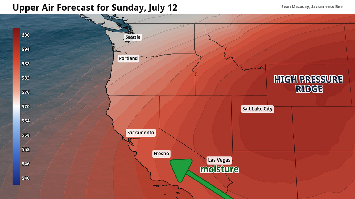
The pattern grows in the days following. Across the western and central United States, another “heat dome” is beginning to take shape. A heat dome is a self-reenforcing mass of high pressure in the upper atmosphere that dominates the sky for thousands of miles. Just as a heat dome brought record-hot temps to the eastern U.S. last week, this heat dome – on our side of the country – will bring hot temps our way.
The heat dome will begin to take shape this weekend, with its center located around Wyoming by Sunday and early next week. Given its location to our northeast, it will drive a warm southeasterly breeze – carrying moisture from the Pacific Ocean – across California and the southwestern U.S.
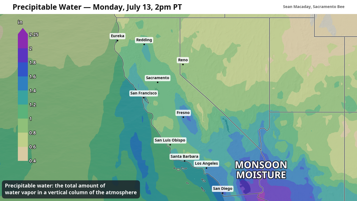
This is the southwestern monsoon, arriving about a month behind schedule and bringing some clouds, humidity and even rain.
The monsoon’s most immediate effects will be more heavily felt in the southwestern U.S. in places such as Las Vegas and Phoenix. But the plume of monsoonal moisture will make a difference for much of Southern California.
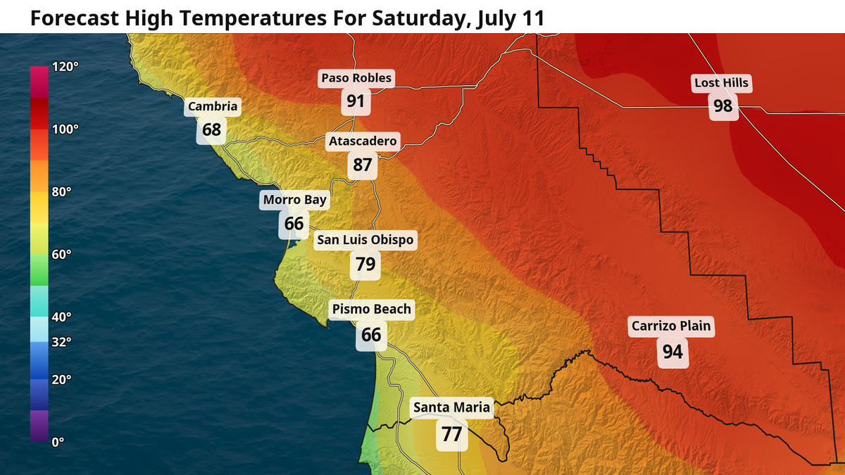
First it will bring extra clouds and heat. On Saturday, that southeasterly offshore breeze will keep the marine layer more at bay. Any morning fog will not linger as long as it otherwise would. High temps hold in the 80s for SLO, and rise well into the 90s further inland for places like Paso Robles — despite some lighter, higher up clouds set to pass through.
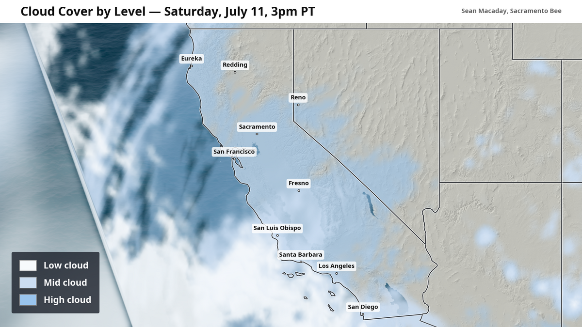
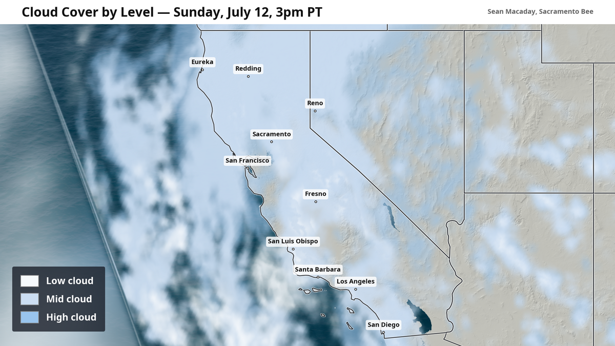
On Sunday, more moisture brings even more clouds. By the afternoon, a few light showers are possible across the southern half of the state as the monsoonal moisture continues to arrive. This includes for places like Fresno, San Luis Obispo and Los Angeles. Any showers would be brief and isolated. Most folks will not encounter these showers. The off-chance for rain repeats again Monday.
Triple digits temps arrive next week
As the high-pressure heat dome continues to grow, it will work to raise temperatures further. Highs over 100 degrees are likely for the entire Central Valley early next week and leaking closer towards the coast in Southern California. Heat domes can be incredibly stable weather patterns, so expect these hot temperatures to linger next week and possibly even longer.
For SLO and locations closer to the water, that translates to high temperatures in the upper 80s. Further inland, highs will quickly rise well above 100 degrees.
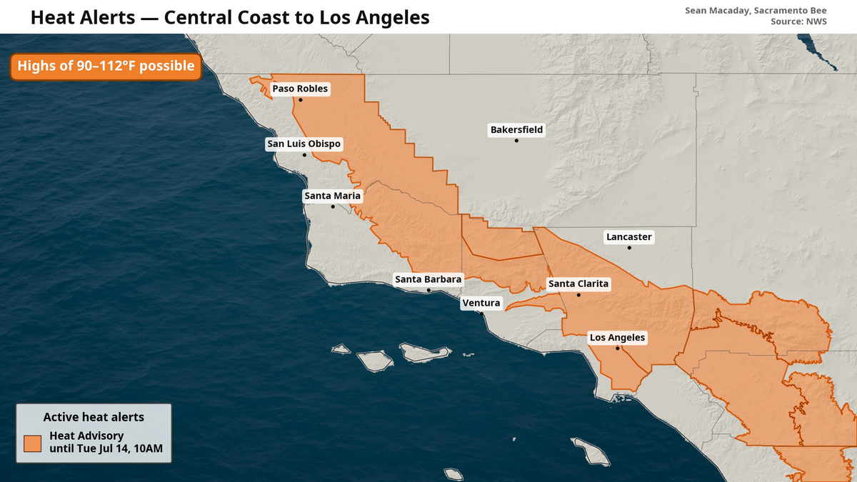
Portions of inland Southern California are under a heat advisory from the National Weather Service into early next week with temperatures expected to reach up to 112 degrees. This includes inland San Luis Obispo and Los Angeles counties. More heat advisories are likely to be issued later this weekend for the week to come across the state.