SLO County weather forecast for the week of May 24: Paso could hit triple digits
Last week we saw mostly clear skies, below seasonal temperatures, relentless gale-force northwesterly winds along the coastline and frigid seawater temperatures.
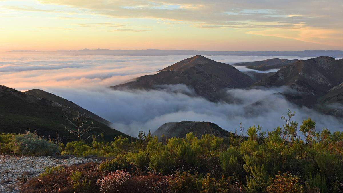
In a weather whiplash pattern change, the northwesterly winds will diminish, and the marine layer will return this upcoming week.
The afternoon northwesterly winds will decrease to fresh to strong (19 to 31 mph) levels on Sunday. Therefore, the low marine clouds will become more prevalent along the coastline.
Sunday’s high temperatures will range between the mid-70s in the coastal valleys and mid-80s in the inland valleys. The beaches will reach the 60s.
High pressure will continue to build over California on Memorial Day and will remain nearly stationary through next week.
This condition will produce decreasing northwesterly winds and increasing inland temperatures; in fact, Paso Robles is expected to reach triple-digit levels.
Historically, this condition produces a persistent marine layer along the coastline. Overall, coastal clouds with areas of fog and drizzle — or “May Gray” — will start Sunday night and could continue through end of the month, perhaps turning into “June Gloom.”
Surf report
A 5- to 7-foot northwesterly (300-degree, deep-water) swell (with an 8- to 13-second period) is forecast along our coastline on Sunday into Memorial Day, decreasing to 3 to 5 feet with the same period on Tuesday through Friday.
A 1-foot Southern Hemisphere (210-degree, deep-water) swell (with a 22- to 24-second period) will arrive along our coastline on Sunday, building to 1- to 3-feet (with an 18- to 20-second period) on Memorial Day. It will remain at this level through Wednesday.
A 2- to 3-foot Southern Hemisphere (195-degree, deep-water) swell (with an 18- to 20-second period) will arrive along our coastline Friday, building to 2 to 4 feet (with a 17- to 19-second period) next weekend.
Seawater temperatures will range between 49 and 53 degrees through Sunday, increasing by the end of next week to 56 to 58 degrees.
This week’s temperatures
LOWS AND HIGHS, PASO ROBLES
SUN | MON | TUE | WED | THU | FRI | SAT | SUN |
45, 93 | 53, 99 | 59, 100 | 60, 97 | 58, 93 | 50, 84 | 51, 85 | 53, 87 |
LOWS AND HIGHS, SAN LUIS OBISPO AND COASTAL VALLEYS
SUN | MON | TUE | WED | THU | FRI | SAT | SUN |
50, 80 | 54, 83 | 57, 84 | 60, 79 | 59, 76 | 55, 74 | 56, 75 | 57, 77 |
PG&E safety tip
Dense fog is likely to develop during the night and morning. Here are some tips from the CHP for driving in foggy conditions:
▪ Drive with lights on low beam. High beams will reflect off the fog, creating a “white wall” effect.
▪ Reduce your speed and watch your speedometer. Fog creates a visual illusion of slow motion when you might actually be speeding.
John Lindsey’s is PG&E’s Diablo Canyon marine meteorologist and a media relations representative. Email him at pgeweather@pge.com or follow him on Twitter @PGE_John.